Real Estate Drone Photography: Shots, Rules and Tips
Real estate drone photography for agents: when a drone helps, the shot list with heights, the FAA Part 107 rules and how to put aerial 360s in a tour.
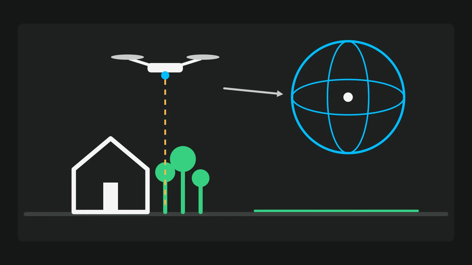
Real estate drone photography shows what a camera on the ground cannot: the plot, the roof, the garden and what is around the home. It helps when the outside is part of what sells the home, and in the US it needs a pilot with a Part 107 certificate. The shots then belong in two places: the listing's photo gallery and the virtual tour, where an aerial 360 can be the first thing a buyer sees. This guide covers which listings gain from it, the shot list with heights, the rules as of November 2026, and how the files reach the listing.
For the ground photos, see our real estate photography tips.
When a drone shot helps a listing, and when it does not
A real estate drone is worth booking when the picture from above answers a question a buyer has. When it does not, it is one more photo between the buyer and the kitchen. This table is practical judgement, not a statistic.
| Kind of property | Does a drone help? | The shot that proves it |
|---|---|---|
| Detached house on a plot | Yes | The plot lines, the garden, the space between neighbours |
| Land or a building plot | Yes, often the main picture | The shape and size of the plot, the access road |
| Near a beach, park, lake or the town centre | Yes | The distance to it, in one picture |
| Large or unusual roof, pool, outbuildings | Yes | What a ground photo cannot fit in |
| Flat in an apartment block | Rarely | One context shot of the building and street, if the view sells it |
| Dense terraced street or a small yard | Rarely | Usually none: the neighbours' roofs fill the frame |
| Near an airport, in controlled airspace | Possible, with authorisation | Plan it days ahead (see the rules below) |
Get the home ready for the camera above
Redfin's guide to preparing a home for drone photos (22 September 2026) gives the seller a short list. From above, everything on the ground shows.
- Clear the roof and gutters of leaves and debris.
- Move the cars off the drive and, if you can, off the street in front.
- Put the bins out of sight.
- Do not run the sprinklers before the shoot: wet paving shows dark.
- Trim branches, but not the day before, so the cuts do not look fresh.
- Set out the garden furniture as if in use; put away toys and hoses.
Do not hide real defects. A photo from above does not replace disclosure.
The shot list: heights, angles and light
The heights below are starting points from practice, not rules. The one hard limit in the US is 400 ft above the ground.
| Shot | Height | Angle | What it shows |
|---|---|---|---|
| Front elevation, low | About roof level, 20 to 35 ft (6 to 10 m) | Camera level or slightly down | The facade without the leaning lines of a ground shot |
| Front three-quarter | 60 to 120 ft (20 to 35 m) | About 45 degrees down | House, drive and garden in one frame |
| Rear three-quarter | Same, from the back | About 45 degrees down | Garden, pool, terrace |
| Top-down of the plot | 150 to 200 ft (45 to 60 m) | Straight down | The plot shape and boundaries |
| Context shot | Higher, never above 400 ft (120 m) | Towards the beach, park, school or centre | Where the home sits |
| Aerial 360 | The context height | All around | The whole setting, as a stop in the tour |
For the top-down, Redfin quotes pilots who say that from 150 ft the roof is the biggest surface in the frame and from 200 ft it is half of it. Go higher only when the plot itself is the point.
For light, the same Redfin guide quotes a pilot who books the hour before sunset. Shooting after sunset counts as civil twilight and changes what the drone needs (see the rules section).
If you also shoot video, four moves cover most listings, each 10 to 20 seconds:
- A slow reveal from behind a tree or over the roof.
- A slow orbit around the house, away from the street.
- A flight towards the front door that stops there, so the tour can start where the clip ends.
- A slow rise from the garden to the context view.
Our guide to real estate video marketing covers how to edit and post them.
The aerial 360 panorama
Many consumer drones stitch a full sphere in their own app. DJI's Mini 4 Pro, for example, has Sphere, 180 degree, Wide Angle and Vertical panorama modes. Shoot it once above the plot, at the context height, with the house a little off centre so the buyer sees it and what is around it.
Export the stitched image, not the separate frames. A full 360 photo is twice as wide as it is high (2:1), and the output size differs by model, so check each file. The free 360 photo checker tests the 2:1 shape, the resolution, the 360 data and whether the horizon is level, before the file goes in a tour.
Do you need a license to fly a drone for real estate? The US rules
Yes. Flying for a listing is flying for business, so the person at the controls needs a remote pilot certificate under 14 CFR 107.12, or must fly under the direct supervision of someone who holds one and can take over. These are the rules as of November 2026.
The remote pilot certificate
Create an IACRA profile, then pass the initial knowledge test at an FAA-approved testing centre. The FAA's drone pilot page puts the centre's fee at about $175; check the current price with the centre. To keep flying, you need recurrent training within the previous 24 calendar months (107.65), and the FAA offers it free online.
Register the drone and broadcast Remote ID
Under Part 107 every drone is registered, whatever its weight: $5 per drone, valid for three years, on FAADroneZone, according to the FAA's registration page. A drone that must be registered must also comply with Remote ID. The under-250 g exemption applies to recreational flyers only.
Check the airspace before the day
Near airports, Class B, C, D and surface Class E airspace need prior authorisation from air traffic control (107.41). LAANC gives it in near real time through FAA-approved apps, up to 90 days ahead. If you need to fly above the altitude shown on the map, the "further coordination" route needs at least 72 hours. The FAA's B4UFLY tool shows the restrictions; LAANC does not check weather or NOTAMs, so do that separately.
The limits that matter at a listing
- Height. No higher than 400 ft above the ground, unless within 400 ft of a structure, and then no more than 400 ft above its top (107.51).
- Speed and weather. 100 mph at most, at least 3 statute miles of visibility, 500 ft below and 2,000 ft away from clouds (same section).
- People below. No flying over people who are not part of the shoot, unless they are under cover or in a stationary vehicle, or the drone meets a subpart D category (107.39). Plan the orbit away from the street and the neighbours' gardens.
- Twilight and night. Civil twilight (30 minutes before sunrise and after sunset) and night need anti-collision lighting visible for 3 statute miles (107.29). Most dusk guides leave this out.
Outside the US
In the UK, since 1 January 2026 you need a Flyer ID for a drone of 100 g or more, and an Operator ID for 250 g or more, or 100 g or more with a camera; new models carry UK class marks (CAA). In the EU, most listing flights fall in the open category: below 120 m, with subcategories A1, A2 and A3 set by the drone's class, operator registration and online training. Each country adds its own no-fly zones and rules, so check the national regulator before the shoot.
Privacy: the seller, the neighbours and the people below
FAA rules are about safety. Privacy is a matter of state and local law, so check your state's rules before the first flight.
The federal voluntary best practices for drone privacy (NTIA, 2016) are not law, but they name real estate directly: agents "may provide a home seller (and possibly immediate neighbors) with prior notice of the estimated date" of the drone photography. They also suggest avoiding images where someone expects privacy, keeping flights over other people's property to a minimum without consent, and blurring people before anything is published.
In practice:
- Tell the seller and the immediate neighbours the date of the flight.
- Frame out the neighbours' gardens and windows.
- Fly when the neighbours' pool or garden is empty.
- Blur faces and number plates with the free blur faces tool.
- Remove the position from files you share outside a tour with remove photo metadata: drone files carry the exact GPS position.
Hire a drone pilot or fly it yourself?
| Hire a Part 107 pilot | Fly it yourself | |
|---|---|---|
| What you need | A booking | The certificate (test about $175), $5 registration per drone, a drone with Remote ID |
| Time | One booking per listing | Study and the test once, airspace checks for every listing |
| Risk | The pilot's insurance (ask for it) | Your own insurance |
| Quality | A portfolio of listing work | Practice |
Prices for hiring vary by market and by package, so ask for a quote per deliverable. Before you book, check:
- The pilot's remote pilot certificate.
- Liability insurance, as Redfin's guide advises.
- Recent listing work, not scenic reels.
- Who files the airspace authorisation, if the home needs one.
- The deliverables in writing: stills as JPEG, the 360 sphere already stitched into one JPEG, clips in MP4 or MOV, and the right to use them in the listing, the tour and social posts.
Put the drone shots in the listing and the tour
Put the best aerial second or third in the listing's gallery, not first, unless the plot or the location is the selling point. Check your MLS's media rules before you upload.
In a Vistura tour, the stitched aerial 360 uploads like any room, on every plan. Link it to the front-door photo with a navigation point, so the buyer lands above the plot and then walks in. An ordinary aerial still fits too, as a "Regular photo (not 360°)" stop, "Shown flat, without turning around", or inside an information point. Next to it, the "What's nearby" panel lists the shops, schools, transport and parks around the home, the ground detail behind the context shot. Our guide on how to make a virtual tour covers the rest of the steps.
On Pro, "Add a video" takes the drone clip itself: MP4 or MOV, even 4K, up to 6 minutes, and Vistura prepares it to play smoothly on phones and makes the cover picture. Show it "On this photo", as a video point on the aerial 360 or the garden, or as a "Watch the video" button on screen. When the clip ends at the front door, the visitor taps "Back to the tour" and the first room is right there.
Checklist before you publish
- Airspace checked and any authorisation in place before the flight.
- No faces or number plates visible.
- GPS position removed from files you share. In a Vistura tour the position in the photos is never kept: you set the address yourself, exact or just the area.
- The 360 is 2:1 and level.
- The clip ends at the front door, the point where you start the tour.
For the photos from the ground, go back to the real estate photography tips.
Frequently asked questions
Can I fly a drone under 250 g for a listing without a certificate?
Not in the US. The weight exemption is for recreational flyers. Flying for a listing is commercial work under Part 107, so the person at the controls needs a remote pilot certificate, and the drone must be registered whatever it weighs. In the UK, a camera drone of 100 g or more needs an Operator ID as well as a Flyer ID.
Can I fly the drone at dusk for twilight photos?
Yes, with the right lights. Civil twilight runs from sunset to 30 minutes after it, and under Part 107 the drone then needs anti-collision lighting visible for 3 statute miles. Redfin's guide quotes a pilot who books the hour before sunset instead, which avoids the lighting requirement.
Do I need the neighbours' permission to fly over their house?
Federal drone rules do not ask for it, but privacy and trespass are a matter of state and local law, so check yours. The federal privacy best practices suggest avoiding flights over other people's property without consent where you can, and telling the neighbours the date of the shoot.
What height is best for real estate drone photos?
There is no single height. Roof level shows the facade, 60 to 120 ft gives the house and garden in one frame, 150 to 200 ft shows the plot, and a context shot can go higher. In the US, stay below 400 ft above the ground, except within 400 ft of a taller structure.
Can a drone 360 photo be part of a virtual tour?
Yes, if the drone's app exports the sphere as one stitched image twice as wide as it is high. Upload it with the room photos and link it to the front door, so buyers start above the plot and then walk in.